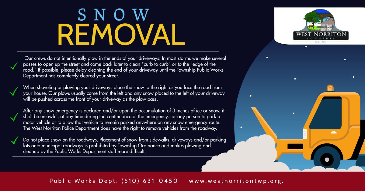
Should there be a need to remove snow, please follow the guidelines on the graphic.
1. Wintry weather is likely for our area as the system moves into the region on Saturday, 1/6 into Sunday, 1/7.
2. Precipitation will fall initially as snow between I-95 and I-78, however a mix with rain or sleet is expected Saturday evening resulting in reduced amounts. Current projections are between 1-4" for the I-95 corridor through the I-78 corridor. Mainly rain is expected near and southeast of I-95 but may begin or end as wet snow near I-95 with little to no accumulation.
3. Rainfall forecast has been increased to an expected 0.75 -1.25 inches of rain with Montgomery County projected for 1-1.5" of rainfall. Localized flooding of low-lying and poor drainage areas remains possible.
Have you signed up for ReadyMontco? It's that time again when forecasts are starting to include wintery weather! Sign up today to receive alerts about severe weather and other important events in Montgomery County to the devices of your choice. Whether you prefer emails, text messages, push notifications or even a phone call - you decide the option that works for you! Visit
www.readymontco.org to sign up today.
This is a vital tool for our first responders to communicate
directly with you. Please sign up to get emergency alerts for Montco and West Norriton Township.